

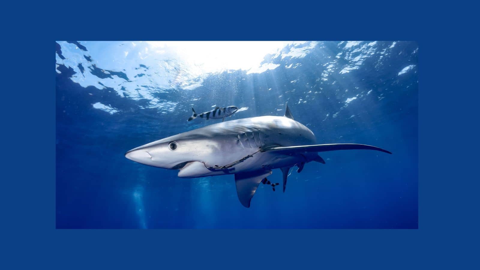
A University of Delaware research team is tagging shortfin mako and blue sharks with ocean-measuring sensors, using the animals’ natural Atlantic range to collect data that could sharpen hurricane intensity forecasts before storms reach the coast.
A shark fin breaking the surface off the U.S. East Coast now carries an extra meaning for scientists at the University of Delaware. Each time a tagged animal surfaces, it can send a burst of ocean data to satellites overhead, turning an ordinary movement through the Atlantic into a brief scientific transmission. Researchers hope those readings can help fill one of hurricane forecasting’s stubborn gaps: what is happening beneath the surface before a storm reaches land.
The project is not designed to tell forecasters where a hurricane will travel. Its focus is intensity, the harder question of how powerful a storm may become.
The work centers on shortfin mako and blue sharks and remains in its early stages. Still, the goal is practical: to give coastal communities better information about how dangerous an approaching storm might be before landfall.
What the Tags Actually Measure
CTD sensors secured to a shark’s dorsal fin record conductivity, temperature, and depth, sending readings to satellites during each surfacing event.
The name describes the job. CTD stands for conductivity, a measurement closely tied to salinity, temperature, and depth. Developed by the Sea Mammal Research Unit at St. Andrews University in Scotland, the tags hold those readings until a shark reaches the surface and its fin clears the water, creating the moment needed to connect with a satellite network.
Aaron Carlisle, the project’s principal investigator and a professor at the University of Delaware’s School of Marine Science and Policy, described how transmission works: “The tags are attached to the dorsal fin. Then every time the shark fins at the surface, the tag can communicate and transmit data to the orbiting network of satellite receivers.”
Those repeated trips through the water column are what give the project its forecasting potential.
The Warm Layer That Feeds Storms
Researchers are focused on the heat content of the ocean’s upper mixed layer, because warmer water at that depth directly fuels hurricane intensity.
Carlisle identified the target: “We are really most interested in the heat content of the top layer of the ocean, which is known as the mixed layer.” He also described the consequence in direct terms: “a warmer mixed layer equals a stronger hurricane, as it holds the heat that feeds hurricanes.” That makes subsurface temperature more than a background detail. It is part of the fuel supply a storm can draw from as it moves.
The Mid-Atlantic Bight remains under-sampled by existing monitoring tools despite how strongly those subsurface conditions influence tropical storm behavior.
Matt Oliver, the Patricia and Charles Robertson Distinguished Professor of Marine Science and Policy at the University of Delaware, explained: “Increasing the quantity and quality of ocean data in the Mid-Atlantic, especially in nearshore and shelf environments, is critical for improving hurricane forecasts. Traditional sensors often miss these areas. That’s where sharks can help.”
So, Why Sharks?
After studying more than 20 years of satellite-tag data across 11 shark species, researchers selected shortfin makos and blue sharks for their surfacing frequency and transmission reliability.
Animal-borne sensors already have a history in polar ocean science, where elephant seals have carried instruments through difficult waters. Sharks offered the same advantage along the East Coast, paired with a broader geographic range and fewer regulations than protected marine mammals. Among the species studied, shortfin makos ranked highest for transmission reliability and surfaced almost twice a day on average.
PhD student Caroline Wiernicki explained why that behavior mattered: “We wanted to identify species that reliably came to the surface and stayed there long enough to establish a strong satellite connection. The performance of the CTD tag is tied directly to how often and predictably the animal breaks the water’s surface.”
The better the surfacing pattern, the better the odds that the tag can send usable data.
Save this article
From a Failed Tag to a Confirmed Transmission
A 2023 mechanical failure on blue sharks led to a redesigned dorsal-fin mount; in May 2025, a shortfin mako successfully transmitted CTD profiles for the first time.
The first-generation tags, deployed on two blue sharks in 2023, did not transmit data consistently. It was a mechanical problem: the antenna could not break the water’s surface during a surfacing event, so the satellite connection was lost before the system could do its job. That early failure gave the team a clear engineering problem to solve.
According to MARACOOS, researchers rebuilt the mount using a rigid housing contoured to the leading edge of the dorsal fin.
“The engineering challenge was designing a mounting system that would reliably keep the tag’s antenna out of the water during surfacing events,” Carlisle said. In May 2025, the revised design went on two shortfin makos, and one successfully transmitted CTD profiles and surface positions.
An Idea With a History
The Delaware team builds on more than two decades of earlier research using marine animals as mobile ocean data collectors, beginning with a University of Miami program launched in 2001.
University of Miami scientists began tagging marine animals with satellite-linked sensors in 2001, covering more than 750 animals. Researchers concluded the dataset was too small to inform storm predictions reliably.
A 2024 Scientific Reports paper co-authored by Carlisle found that one salmon shark in the Gulf of Alaska produced 56 geolocated profiles over 36 days in 2015. In fall 2021, a University of Miami effort off Cape Cod tagged 29 sharks across two deployments and analyzed more than 8,000 profiles from the first trip alone.
Building Toward a Global Network
No shark-collected data has yet been confirmed in an operational hurricane forecast. Still, the Delaware team is collaborating with MARACOOS to route ocean profiles from tagged sharks into the data infrastructure meteorologists rely on, with at least two more deployments planned for summer 2026.
Carlisle described the longer horizon: “This is a long-term vision. We’re working toward a global system where marine animals, including sharks, are routinely contributing real-time ocean data. But getting there isn’t easy — this is a completely new way of collecting information.
It’s taken a lot of trial and error to figure out how to get the technology to function effectively on them. Each round of tagging teaches us something new — early tags failed, so we adjusted; the next round worked better but brought new hurdles. That iterative process is just part of breaking new ground.”
Wiernicki also noted that success could give communities from North Carolina to Massachusetts more reliable information about approaching storms and stronger coastal resilience.
If scientists could deliver more reliable information about a hurricane’s intensity before it made landfall, how would that change the decisions you make for your family or your home?
Related Articles:
- 5 Mind-Blowing Things Scientists Have Created Using DNA
- Scientists say these 10 warning signs resemble Earth’s past mass extinctions
- Scientists Confirm Microplastics Are Now in Nearly Every Major Food Group. Here’s What That Means for Your Diet
- Scientists are questioning whether humans can adapt to extreme heat fast enough